Eltel has conducted a pilot study to demonstrate the environmental, safety and efficiency benefits of using drone mapping for infranet planning.
Making science fiction reality
Imagine drones scanning and mapping entire infranets to within centimetres to allow accurate network planning and maintenance. What if an operator could evaluate a network issue via a drone from hundreds of kilometres away, or even if drones could actually carry out maintenance work at height to avoid technician safety risks?
This may sound like something from the realm of science fiction, but Eltel has already begun investigating the potential to use drones to design and maintain infranets.
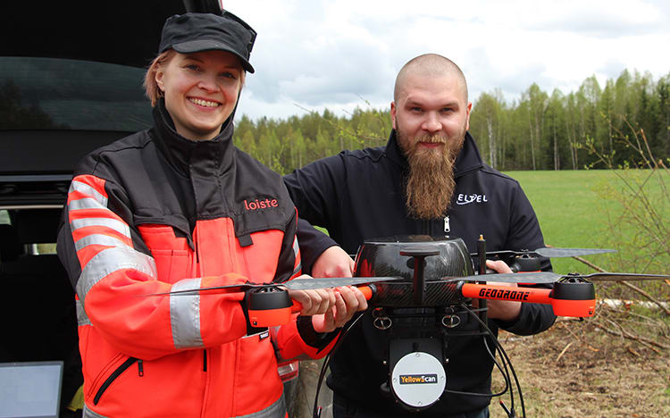
Innovative drone pilot study
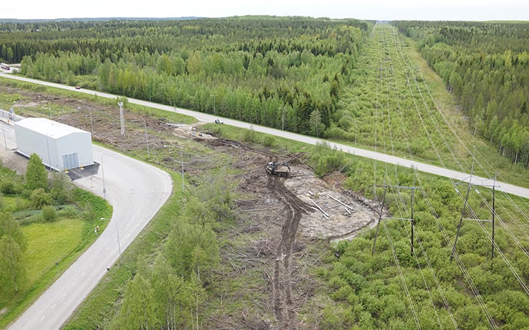
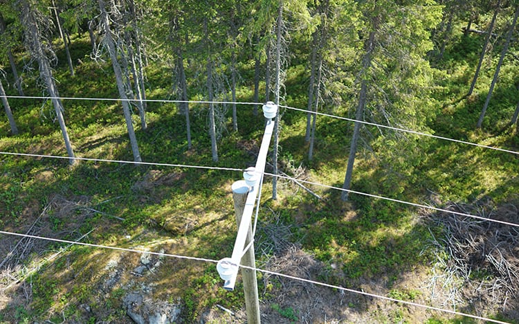
Eltel recently conducted a drone mapping pilot study together with a Finnish energy company to investigate how drones can be used for power grid design, maintenance and issue solving. The pilot demonstrated how each flight can scan a 100m wide area, and these maps can be overlapped to create models with an accuracy of between 3 and 6 cm.
“Inaccurate conventional mapping techniques, particularly in winter with snow coverage, can lead to additional costs and even project delays or stoppages,” says Aki Palo, Terrain Planning Manager. “The idea with drone mapping is that it can be used to produce an accurate basis for our infranet planning – even during the winter.”
Potential to reduce emissions and improve safety
The pilot study highlights two main potential benefits – reduced vehicle emissions and improved technician safety.
“As drones allow all site measurements to be made in a single visit and then worked on remotely – we can reduce vehicle use and emissions by around 90 percent,” says Palo. “Reducing the need for field work in difficult terrain can also reduce the risk of slips and falls, which are Eltel’s most common causes of accidents.”
Streamlined and cost-effective operations
The study demonstrates that drones can streamline Eltel’s existing operations and help reduce costs.
“Drone flights are not only quicker and easier to execute than conventional mapping techniques,” says Palo. “Their accuracy can help avoid the need for errors, re-planning and project delays – to ultimately ensure efficient and cost-effective operations.”
Eltel is currently preparing a report to document the key findings and benefits identified in the drone pilot. The long-term goal is to incorporate drone mapping into its day-to-day processes to enhance cost-competitiveness.
What is drone mapping?
Drones with laser scanners can create accurate 3D terrain models without vegetation. The models are also more efficient to create than conventional mapping and can be used to plan projects remotely.
Other potential drone application areas
- Monitoring construction project progress.
- Conducting potentially dangerous work at height to avoid safety risks.
- Mapping district heating networks with thermal cameras.
- 3D substation modelling to remotely plan maintenance work.
Read more

Partnership serves 400,000 customers in Helsinki
In 2020, Eltel entered into a five-year frame agreement to construct and maintain Helsinki’s electricity distribution network – to promote efficiency and quality in close partnership with the network owner.

Understanding technicians’ issues optimises operations
Eltel Finland is working to better understand the day-to-day challenges its technicians face and improve planning procedures to ultimately enhance productivity.
Power
Our power services enable the electrification of society, which is essential for building more sustainable energy solutions and achieving national carbon-neutrality goals.